Smart city applications need accurately labeled geospatial training data to classify land use, map infrastructure, analyze traffic patterns, and support urban policy decisions. But annotation quality directly impacts AI performance—mislabeled zones lead to flawed predictions, and inconsistent boundary mapping creates unreliable models.
Urban planning data annotation requires understanding your specific labeling requirements, following detailed geospatial annotation guidelines consistently, and maintaining quality across large satellite and aerial imagery datasets with complex spatial relationships.
FiveS Digital provides scalable urban planning data annotation services—training annotators on your specific requirements and delivering consistent labeling quality across large geospatial datasets.
With 16 years managing data operations and 50 million+ annotations delivered annually, we provide trained annotation teams working from detailed guidelines you provide. Our annotators are trained specifically on geospatial image recognition—learning to classify land use zones, delineate building footprints, map transportation networks, and identify infrastructure based on your reference materials and expert feedback.
We handle satellite imagery, drone data, aerial photography, and GIS datasets—annotating according to your urban planning taxonomies and specifications. Deploy pilot projects in 2-3 weeks with quality validation processes and 40-60% cost savings versus building in-house annotation teams. Scale from 10 to 100+ trained annotators based on your project timeline and data volume.
Urban Planning Annotation Services We Provide
Land Use Classification: Annotating satellite and aerial imagery to classify residential, commercial, industrial, institutional, open space, and mixed-use areas based on your taxonomy.
Transportation Networks: Mapping roads, highways, transit lines, bike lanes, pedestrian paths, and parking facilities from aerial imagery and GIS data.
Building Footprint Delineation: Creating polygon annotations outlining individual buildings with attributes you specify (height estimates, building types, conditions).
Infrastructure Mapping: Identifying and labeling utility infrastructure, water systems, electrical grids, emergency facilities, and public amenities based on your requirements.
Zoning and Boundary Mapping: Delineating property parcels, zoning districts, administrative boundaries, and regulatory overlay zones following your specifications.
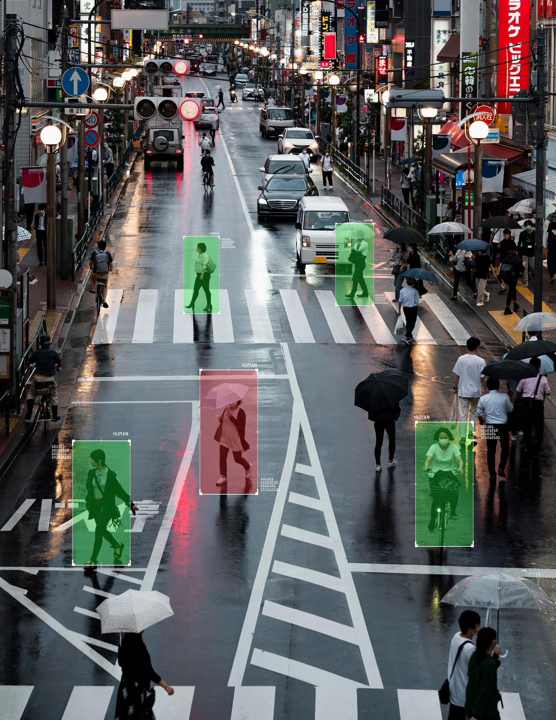
Traffic and Mobility Analysis: Annotating traffic flow patterns, vehicle counts, congestion areas, and transportation mode distributions from video and imagery.
Proven Delivery for Smart City Projects
50 Million+ Total Annotations: Delivered annually across all industries with proven data operations expertise.
Scalable Teams: Deploy 10 to 100+ trained annotators within 2-3 weeks based on project requirements.
Quality Processes: Multi-tier validation including peer review, supervisor checks, and expert feedback integration.
Fast Turnaround: 2-3 week pilot projects demonstrating quality before full-scale deployment.
Cost Efficiency: 40-60% savings versus building in-house annotation teams with infrastructure and training overhead.
Flexible Scaling: Adapt team size to match your data collection volumes and project timelines.