Your AgriTech platform needs accurately labeled training data to detect crop diseases, identify weeds, estimate yields, and monitor crop health. But annotation quality directly impacts your AI performance—mislabeled images lead to unreliable predictions, and inconsistent annotations create models farmers won't trust.
Agricultural data annotation requires understanding your specific labeling requirements, following detailed annotation guidelines consistently, and maintaining quality across thousands of images captured in different field conditions, lighting, and crop growth stages.
FiveS Digital provides scalable agricultural data annotation services—training annotators on your specific requirements and delivering consistent labeling quality across large datasets.
With 16 years managing data operations and 50 million+ annotations delivered annually, we provide trained annotation teams working from detailed guidelines you provide. Our annotators are trained specifically on agricultural image recognition—learning to identify crops, label disease symptoms, mark weed locations, count fruits, and annotate field boundaries based on your reference materials and expert feedback.
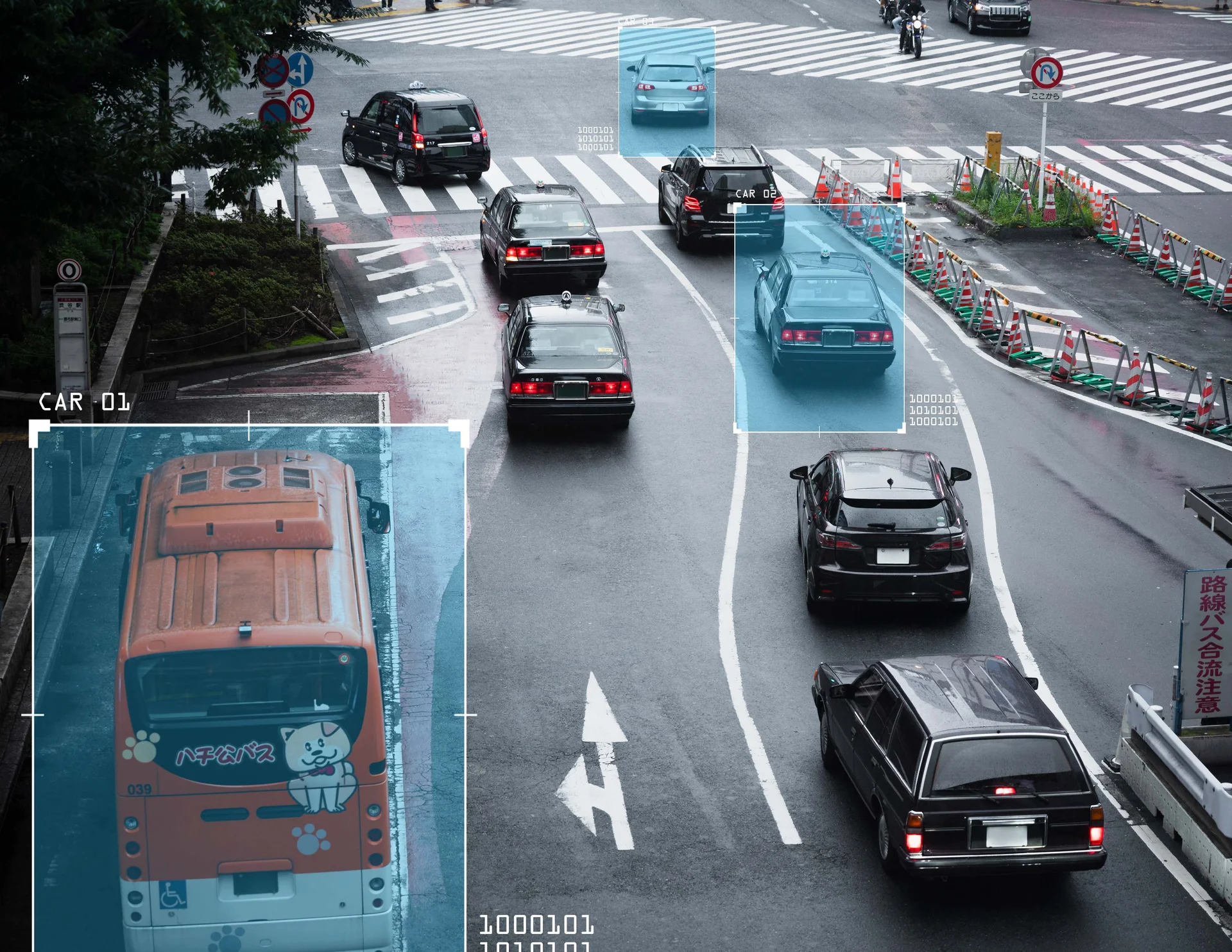
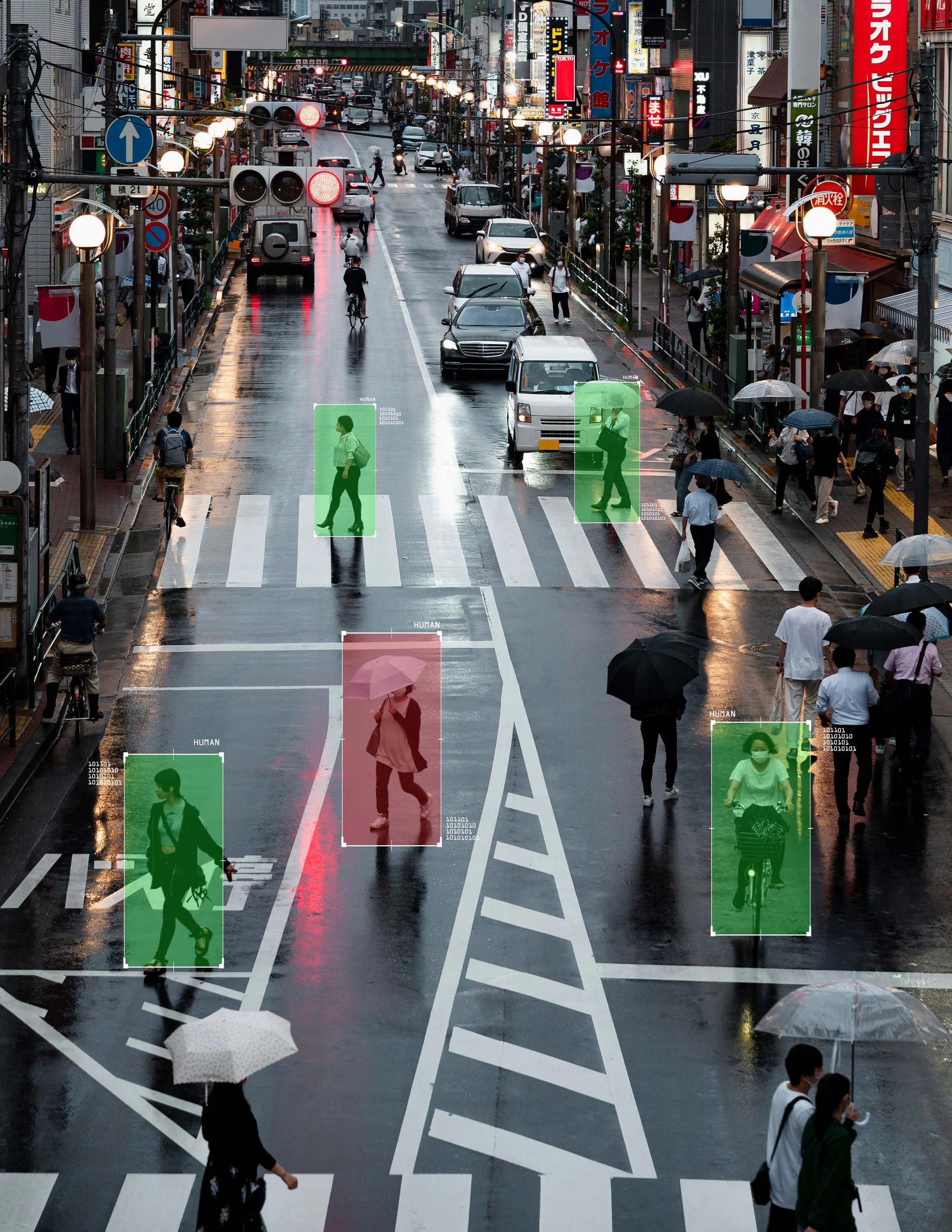
We handle drone imagery, satellite data, ground-level cameras, and multispectral sensors—annotating according to your taxonomies and specifications. Deploy pilot projects in 2-3 weeks with quality validation processes and 40-60% cost savings versus building in-house annotation teams. Scale from 10 to 100+ trained annotators based on your project timeline and data volume.
Agricultural Annotation Services We Provide
Crop Health Monitoring: Annotating drone and satellite imagery showing crop vigor variations, stress areas, and field conditions based on your classification system.
Disease & Pest Detection: Labeling disease symptoms and pest damage according to your taxonomies, marking affected areas with bounding boxes or segmentation masks.
Weed Identification: Detecting and labeling weed locations in crop fields using your reference materials, supporting precision application systems.
Yield Estimation: Counting fruits, measuring crop density, and annotating maturity indicators for harvest planning applications.
Field Mapping: Delineating field boundaries, crop types, and infrastructure from aerial imagery for precision agriculture platforms.
Growth Stage Tracking: Labeling crop development stages across time-series imagery based on your phenological classifications.
Proven Delivery for AgriTech Companies
50 Million+ Total Annotations: Delivered annually across all industries with proven data operations expertise.
Scalable Teams: Deploy 10 to 100+ trained annotators within 2-3 weeks based on project requirements.
Quality Processes: Multi-tier validation including peer review, supervisor checks, and expert feedback integration.
Fast Turnaround: 2-3 week pilot projects demonstrating quality before full-scale deployment.
Cost Efficiency: 40-60% savings versus building in-house annotation teams with infrastructure and training overhead.
Flexible Scaling: Adapt team size to match your data collection volumes and project timelines.